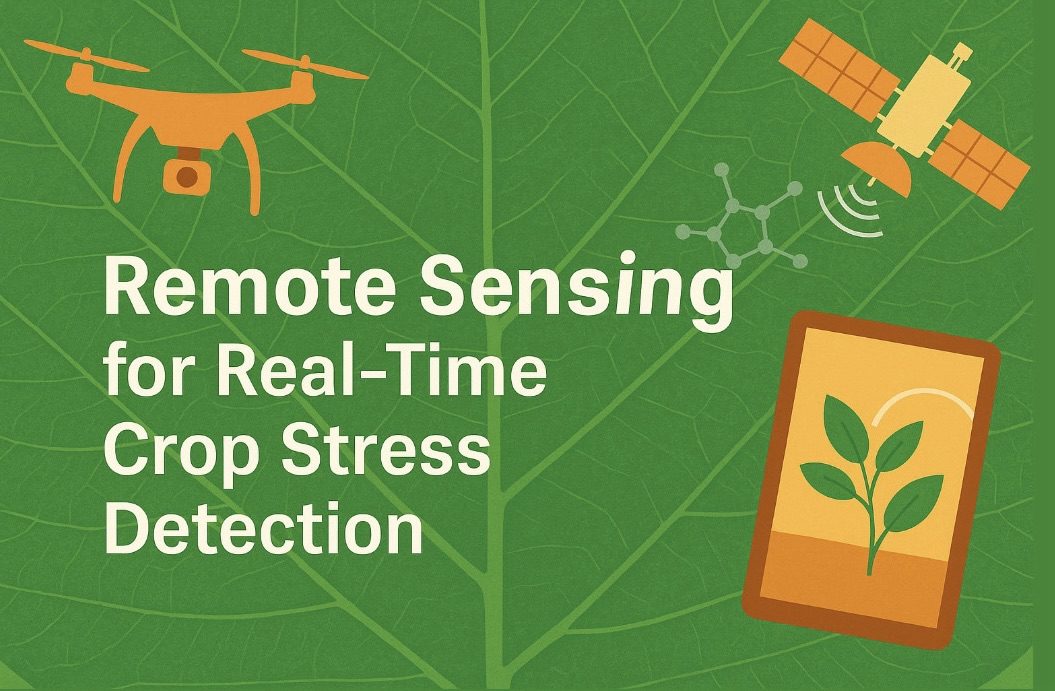
In an age where climate variability, population pressure, and shrinking agricultural resources are challenging global food security, the need for innovative solutions in crop monitoring and stress detection has never been more pressing. Traditional field scouting, although invaluable, is no longer sufficient for meeting the demands of large-scale, precision-based agriculture. This is where remote sensing—a sophisticated, non-invasive technology—enters the stage. Through satellites, drones, and ground-based sensors, remote sensing offers a bird’s-eye view of crop health, enabling timely and targeted interventions. But the technology has evolved far beyond simple imaging; it now delves into detecting real-time physiological stress at the molecular and cellular levels through spectral signatures and thermal responses.
Remote sensing is rapidly transforming agriculture from a reactive discipline to a proactive and predictive one. By capturing data across the electromagnetic spectrum and integrating it with artificial intelligence and machine learning algorithms, researchers and farmers can now identify water stress, nutrient deficiencies, pest attacks, and disease outbreaks before visible symptoms even appear. This article explores how remote sensing technologies are revolutionizing the detection of crop stress in real time, the underlying science that powers it, the types of stress that can be monitored, and the future potential of this evolving field.
The Fundamentals of Remote Sensing in Agriculture
At its core, remote sensing involves collecting information about objects or phenomena without making physical contact. In agriculture, this translates into monitoring plant traits such as chlorophyll content, canopy temperature, leaf area index, and water status using sensors mounted on satellites, aircraft, drones, or ground-based platforms. These sensors capture data in various spectral bands—visible, near-infrared, shortwave infrared, and thermal infrared—that correspond to different physiological properties of plants.
Plants interact with light in unique ways. Healthy vegetation reflects more near-infrared (NIR) and green light, while absorbing more red and blue wavelengths due to chlorophyll activity. Under stress conditions, such as drought or disease, these reflectance patterns change, making it possible to detect deviations from normal crop performance. By analyzing these subtle shifts across thousands of hectares in near real-time, remote sensing offers unprecedented insight into crop health and stress response.
Spectral Indices: The Language of Crop Stress
To translate spectral data into meaningful biological information, scientists use mathematical expressions known as vegetation indices. These indices are ratios or differences between reflectance values in specific spectral bands, designed to highlight particular plant traits.
The most well-known of these is the Normalized Difference Vegetation Index (NDVI), which compares NIR and red light to assess vegetation greenness and vigor. While NDVI is effective in indicating biomass and general health, it is limited in detecting specific types of stress. Therefore, more advanced indices have been developed to monitor particular physiological aspects.
For example, the Photochemical Reflectance Index (PRI) is sensitive to changes in xanthophyll pigments and is used to assess photosynthetic light use efficiency. The Water Index (WI) and Normalized Difference Water Index (NDWI) are valuable for detecting water stress, while the Red Edge Position (REP) is sensitive to nitrogen content and chlorophyll concentration. These indices allow for precise monitoring of crop stress long before visual symptoms become evident, enabling timely irrigation, fertilization, or pest control measures.
Thermal Remote Sensing: A Window into Plant Temperature
Another powerful aspect of remote sensing is thermal imaging. Plants transpire water through their stomata, which cools their leaves much like perspiration cools human skin. When water becomes limiting, stomata close to prevent moisture loss, causing leaf temperatures to rise. Thermal cameras can detect this rise in canopy temperature and identify water stress at an early stage.
The Crop Water Stress Index (CWSI), derived from thermal data, is used to quantify water stress and guide precision irrigation. Drones equipped with thermal sensors can fly over fields during peak daylight hours and identify zones where crops are under heat stress, allowing for efficient water use and avoiding over-irrigation.
Thermal sensing also complements spectral data, offering a multidimensional view of plant stress. For instance, a drop in chlorophyll content might be due to nutrient deficiency or disease, but a simultaneous increase in temperature confirms that the plant is undergoing physiological stress, narrowing down the diagnosis.
Hyperspectral Imaging: Unlocking Molecular Signatures
While multispectral sensors capture data in a few broad bands, hyperspectral sensors acquire hundreds of narrow bands, producing detailed spectral fingerprints of vegetation. This allows researchers to detect subtle biochemical changes in plants, such as pigment degradation, protein denaturation, and oxidative stress.
Hyperspectral imaging is particularly valuable for early disease detection. Pathogens alter the cellular structure and metabolism of leaves even before symptoms like yellowing or wilting appear. These changes are reflected in specific absorption features across the spectrum. By analyzing hyperspectral data with machine learning algorithms, scientists can differentiate between types of pathogens and quantify the extent of infection.
This level of granularity is crucial for integrated pest and disease management, reducing the reliance on blanket pesticide applications and enabling site-specific treatment. Though hyperspectral systems are currently more expensive and complex, advances in sensor technology and data processing are making them increasingly accessible for commercial farming.
Unmanned Aerial Vehicles (UAVs)/ Drones
Drones or UAVs have emerged as one of the most versatile platforms for remote sensing in agriculture. They offer high spatial and temporal resolution, can be deployed quickly, and are cost-effective for small to medium-sized farms. Drones equipped with RGB, multispectral, thermal, or hyperspectral cameras can fly over fields and collect georeferenced data within minutes.
This flexibility allows for dynamic crop monitoring during different growth stages. UAVs are particularly effective for capturing variability within fields, identifying areas of poor growth, lodging, or stress, and creating prescription maps for variable-rate applications of fertilizers or water.
Furthermore, drone data can be integrated with other sources—such as satellite imagery or ground sensors—to build comprehensive decision support systems. Combined with GPS and AI-based analytics, UAVs are enabling a new era of precision farming that is both responsive and sustainable.
Detecting Specific Stress Types: Water, Nutrient, and Biotic
One of the most valuable contributions of remote sensing is its ability to distinguish between different types of crop stress based on spectral and thermal signatures. Water stress, for instance, leads to increased reflectance in the shortwave infrared and higher canopy temperatures. Nutrient deficiencies, such as nitrogen or phosphorus, cause distinct changes in chlorophyll content, visible in the red and red-edge bands.
Biotic stresses—caused by insects, fungi, bacteria, or viruses—create patchy patterns in canopy reflectance and can often be identified through spectral anomalies. For example, fungal infections like rust or powdery mildew disrupt chlorophyll synthesis, which is evident in the decline of NIR reflectance.
Some advanced systems even use pattern recognition and spectral libraries to identify specific diseases or pest infestations. This capability allows for early detection and precise treatment, minimizing yield loss and reducing environmental impact.
Integrating AI and Machine Learning with Remote Sensing
As the volume and complexity of remote sensing data continue to grow, artificial intelligence has become indispensable in making sense of it. Machine learning models can be trained to recognize stress patterns, classify disease types, and predict yield outcomes based on historical and real-time data.
Convolutional neural networks (CNNs), decision trees, support vector machines, and deep learning algorithms are increasingly being applied to agricultural datasets. These models can analyze thousands of images and extract patterns that are not apparent to the human eye. Moreover, they can improve over time by learning from new data, making stress detection systems smarter and more accurate.
The integration of AI with remote sensing not only accelerates data interpretation but also enables predictive analytics. By identifying trends and anomalies before they escalate, farmers can plan interventions more effectively, allocate resources wisely, and improve overall farm resilience.
Ground-Truthing and Calibration: Linking Data to Reality
Despite its power, remote sensing is not infallible. To ensure accuracy, it must be calibrated and validated against ground truth data. This involves collecting field measurements—such as leaf water potential, chlorophyll content, or soil moisture—and correlating them with sensor data.
Ground-truthing not only enhances the reliability of remote sensing models but also refines the algorithms used for stress detection. In many research projects, ground data is used to train AI models, ensuring that their predictions are biologically meaningful and not merely statistical artifacts.
Moreover, integrating ground-based sensors with remote platforms creates a multi-layered monitoring system. Soil probes, canopy temperature sensors, and leaf wetness meters provide continuous data that complements aerial observations, resulting in a more holistic understanding of plant health.
Applications in Smallholder and Large-Scale Farming
Remote sensing holds promise for both large-scale commercial agriculture and smallholder farms. In developed countries, agribusinesses use high-resolution satellite imagery, autonomous drones, and cloud-based platforms to monitor thousands of acres with ease. They integrate weather forecasts, market data, and field observations to optimize productivity and profitability.
For smallholder farmers, especially in developing countries, low-cost drones and open-access satellite platforms like Sentinel-2 and Landsat are making remote sensing more accessible. Mobile apps linked with satellite imagery can help farmers identify problems in their fields, even with limited technical expertise. NGOs and government programs are increasingly using these tools to support climate-smart agriculture and improve food security.
Additionally, agri-tech startups are developing subscription-based services that provide farmers with weekly stress maps, yield forecasts, and management recommendations based on remote sensing data. These services democratize technology, ensuring that even resource-poor farmers can benefit from cutting-edge science.
Future Perspectives: Toward Autonomous Crop Monitoring
The future of remote sensing lies in greater automation, integration, and miniaturization. Compact hyperspectral sensors, AI-driven analytics, and autonomous drone swarms are already in development. These technologies will enable fully automated crop monitoring systems that require minimal human intervention.
Satellites with daily revisit cycles, improved spatial resolution, and enhanced spectral capabilities are being launched to provide more detailed and timely data. 5G networks and edge computing will allow real-time data transmission and processing, making it possible to detect stress and recommend actions within minutes.
Remote sensing will also play a critical role in climate resilience. By monitoring changes in crop phenology, drought patterns, and pest outbreaks, it will help farmers adapt to climate change and build more resilient agricultural systems.
Ultimately, the integration of molecular biology, remote sensing, and data science will lead to a new paradigm in plant health monitoring. By connecting physiological signals at the cellular level with landscape-level observations, researchers can uncover the full complexity of plant-environment interactions.
Conclusion
Remote sensing is more than just a technological advancement—it is a revolution in how we see and understand the living green layer of our planet. By turning spectral data into biological insight, it offers a powerful lens for real-time crop stress detection. This ability to monitor, predict, and respond to stress across scales—from individual leaves to entire landscapes—can fundamentally change the way we grow food.
As technology becomes more accessible and integrated, remote sensing will not just serve agronomists and researchers but also empower farmers to make better decisions, conserve resources, and secure harvests in an uncertain future. The field continues to evolve rapidly, and its full potential is only beginning to unfold.
In a world where every drop of water, every nutrient molecule, and every ray of sunlight counts, remote sensing ensures that nothing goes unnoticed. It transforms light into knowledge, pixels into patterns, and data into decisions—making it one of the most critical tools in modern sustainable agriculture.