In the face of an ever-growing global population and the increasing unpredictability of climate change, the agricultural sector finds itself at a critical juncture. Ensuring food security while maintaining ecological sustainability requires not just more inputs, but smarter and more precise approaches. Among the most promising innovations transforming modern agriculture is the application of remote sensing technology. Remote sensing allows for the non-destructive, real-time monitoring of crop health and environmental conditions across vast areas, making it a valuable tool for detecting and managing crop stress.
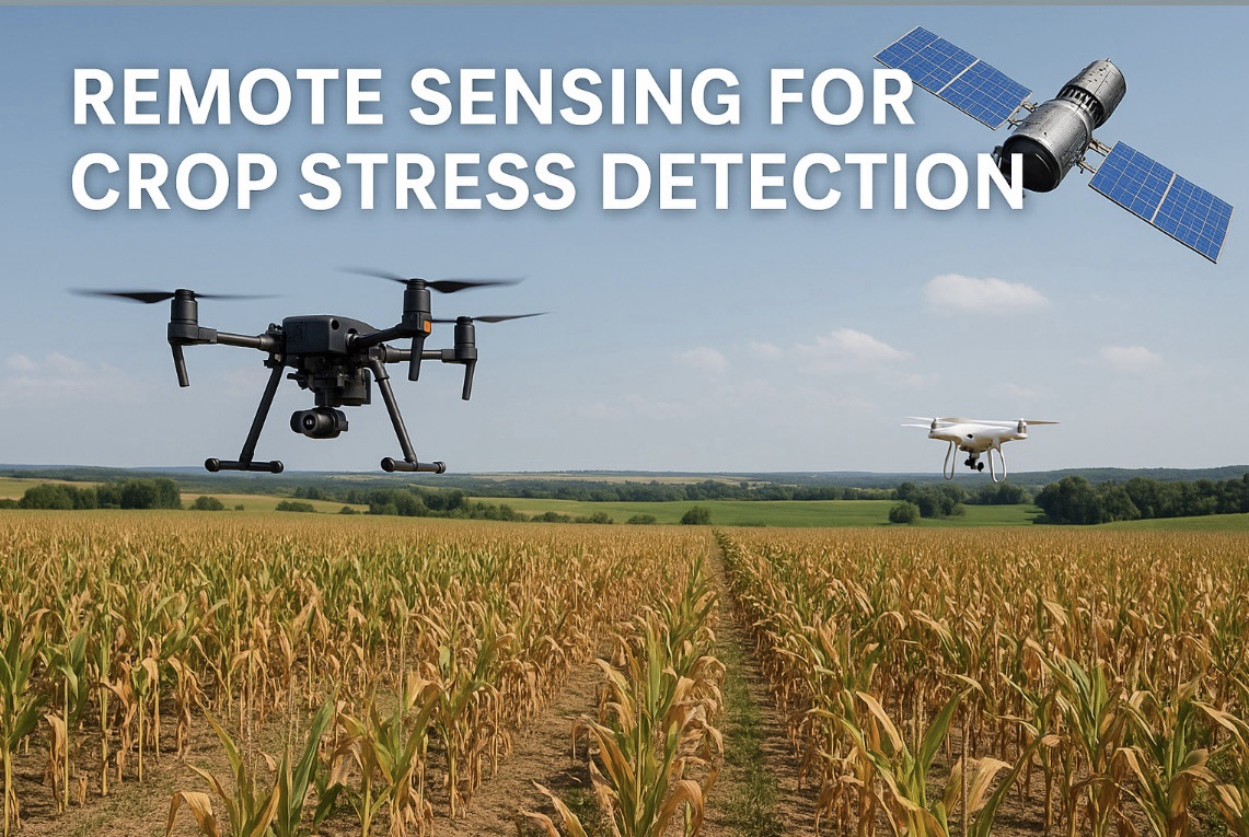
Crop stress, whether induced by drought, heat, salinity, nutrient deficiencies, or pest infestations, poses a significant threat to yield and quality. Traditional field-based scouting methods are labor-intensive, time-consuming, and often provide only localized insights. Remote sensing, in contrast, offers a bird’s-eye view of fields and provides continuous, scalable data on crop performance. From satellites and drones to hyperspectral sensors and thermal cameras, a wide array of tools is now available to monitor crops with unprecedented precision.
This article explores the fundamental principles of remote sensing, its major platforms and sensors, key vegetation indices, and how it is revolutionizing the detection of biotic and abiotic stresses in crops. We will also delve into real-world applications, integration with decision support systems, challenges, and future prospects, illustrating how remote sensing is redefining how we view plant stress from space to soil.
Understanding Remote Sensing in Agriculture’s
Remote sensing refers to the acquisition of information about an object or phenomenon without direct contact. In the context of agriculture, it involves capturing data from crops using sensors mounted on satellites, aerial vehicles, or ground-based platforms. These sensors measure reflected or emitted radiation from the earth’s surface across various portions of the electromagnetic spectrum, including visible, near-infrared (NIR), shortwave infrared (SWIR), and thermal bands.
Each part of the spectrum provides different information about the plant. For instance, healthy vegetation reflects more NIR light due to internal leaf structure, while stressed plants typically reflect more red light and less NIR. By analyzing these patterns, remote sensing technologies can detect physiological changes in crops well before visual symptoms appear, allowing for early intervention and management.
Remote sensing can be classified into two types: passive and active. Passive sensors rely on natural sunlight to illuminate the target and measure reflected radiation. Satellite sensors like Landsat and Sentinel-2 fall into this category. Active sensors, such as LiDAR or synthetic aperture radar (SAR), emit their own signal and detect how it interacts with the crop canopy. These systems are especially useful in cloudy or nighttime conditions where passive systems may fail.
Remote Sensing Platforms: From Satellites to UAVs
The choice of remote sensing platform greatly influences the spatial, temporal, and spectral resolution of the data collected. Several platforms are commonly used in agricultural monitoring, each with its advantages and limitations.
Satellite-based remote sensing offers broad coverage and regular revisit times, making it ideal for regional or national scale monitoring. Missions such as Landsat, Sentinel-2, MODIS, and WorldView provide high-resolution imagery for vegetation assessment. While satellite imagery is cost-effective and widely accessible, its spatial resolution may not be sufficient for smallholder farms, and it is often hindered by cloud cover and atmospheric disturbances.
Unmanned Aerial Vehicles (UAVs), commonly known as drones, are gaining popularity for field-level monitoring. Drones equipped with multispectral, hyperspectral, or thermal sensors can fly at low altitudes, capturing high-resolution data tailored to specific research or management needs. Unlike satellites, UAVs provide greater flexibility in timing and frequency of data collection, enabling farmers and researchers to monitor stress dynamics at critical growth stages.
Manned aircraft and ground-based platforms also serve niche roles, particularly in research trials and experimental plots. These systems often serve as intermediate steps between field measurements and large-scale satellite observations, helping calibrate and validate remote sensing models.
Spectral Signatures and Vegetation Indices
Plants interact with electromagnetic radiation in distinct ways, depending on their physiological and biochemical state. Healthy plants absorb light in the blue and red regions for photosynthesis, while reflecting green light, which is why they appear green to the human eye. The near-infrared region, largely unaffected by chlorophyll, is reflected strongly by healthy cell walls and internal structures. Stress factors that affect chlorophyll content, water status, or cellular structure alter these spectral signatures, which can be captured and interpreted through remote sensing.
Vegetation indices are mathematical combinations of reflectance values from different spectral bands, designed to enhance certain features of the crop canopy and minimize background noise. The most widely used index is the Normalized Difference Vegetation Index (NDVI), which measures the difference between NIR and red reflectance. High NDVI values typically indicate healthy, green biomass, whereas lower values suggest stress or poor vigor.
Other indices such as the Enhanced Vegetation Index (EVI), Normalized Difference Water Index (NDWI), Photochemical Reflectance Index (PRI), and Red Edge Chlorophyll Index provide additional insights into water content, photosynthetic efficiency, and pigment dynamics. Advances in hyperspectral imaging allow for even more detailed analysis by capturing hundreds of narrow spectral bands, enabling the detection of subtle stress signatures that multispectral systems might miss.
Detecting Abiotic Stress Using Remote Sensing
Abiotic stresses such as drought, heat, nutrient deficiency, and salinity impose significant limitations on crop productivity. These stresses often result in physiological changes that precede visible symptoms, making early detection crucial for timely management.
Drought stress typically reduces transpiration, leading to increased leaf temperature and reduced canopy water content. Thermal imaging sensors can detect elevated canopy temperatures, providing early signals of water stress. Simultaneously, indices like NDWI and the Crop Water Stress Index (CWSI) offer quantitative assessments of water availability and plant hydration status.
Heat stress causes similar changes in transpiration and photosynthesis, which manifest as changes in spectral reflectance. Reflectance in the red edge and NIR regions may decrease due to structural damage or pigment degradation. Hyperspectral data can capture these subtle shifts, allowing for precise detection of heat-induced stress at early stages.
Nutrient deficiencies, particularly of nitrogen, phosphorus, and potassium, influence chlorophyll content and leaf pigmentation. These changes are reflected in reduced NDVI or altered PRI values. By integrating spectral data with field observations, it becomes possible to map nutrient stress and guide variable-rate fertilization.
Salinity stress leads to osmotic imbalance, ion toxicity, and chlorosis, all of which affect reflectance patterns. Remote sensing can help identify salinity hotspots within a field and support targeted reclamation or management practices.
Monitoring Biotic Stress: Pathogens and Pests
Biotic stresses, including diseases and insect infestations, also leave detectable signatures on plant canopies. Although the symptoms may vary widely depending on the pathogen or pest involved, they often share common features such as chlorosis, necrosis, and canopy thinning.
Remote sensing allows for the early detection of disease outbreaks, often before they are visible to the naked eye. Fungal infections, for instance, may reduce chlorophyll content and alter leaf structure, affecting both visible and NIR reflectance. Viral infections can cause mottling and discoloration, which hyperspectral sensors can detect with high specificity.
Insect feeding damages leaf surfaces and may lead to wilting or discoloration. Multispectral indices can detect changes in canopy uniformity and pigment content, flagging affected zones for closer inspection or treatment. Coupling remote sensing data with machine learning algorithms enhances the accuracy of biotic stress classification, enabling automated detection and decision-making.
Integration with Crop Models and Decision Support Systems
Remote sensing data becomes even more powerful when integrated with crop growth models and decision support systems (DSS). These systems simulate crop development based on environmental and management inputs, providing forecasts of yield, water demand, and stress risk.
By feeding real-time or near-real-time remote sensing data into crop models, it is possible to improve their accuracy and responsiveness. For instance, satellite-derived NDVI can be used to adjust biomass estimates, while thermal data can inform evapotranspiration calculations. This fusion of data enhances the model’s ability to reflect actual field conditions and generate actionable insights.
Decision support systems built on this integration can guide irrigation scheduling, pest control, nutrient application, and harvest timing. Precision agriculture platforms often incorporate remote sensing data, soil sensors, and weather forecasts into user-friendly dashboards that empower farmers to make informed choices.
Case Studies and Applications
Several successful applications of remote sensing in crop stress detection have been reported across diverse agroecosystems. In India, remote sensing is being used to monitor drought and crop yield forecasts across states using data from INSAT and Sentinel satellites. The FASAL (Forecasting Agricultural Output using Space, Agro-meteorology and Land-based Observations) project by ISRO has been instrumental in this regard.
In Australia, remote sensing supports viticulture by monitoring vine health, water stress, and disease risk, enabling high-value producers to fine-tune their management. Similarly, in the US Midwest, corn and soybean growers leverage UAV-based NDVI mapping to detect nutrient deficiencies and guide fertilization.
In sub-Saharan Africa, organizations like the International Maize and Wheat Improvement Center (CIMMYT) are using drone imagery to screen stress-tolerant genotypes under field conditions. Such applications demonstrate the adaptability and value of remote sensing across scales and crop systems.
Limitations and Challenges
Despite its many advantages, remote sensing in agriculture is not without limitations. Spatial resolution remains a challenge, especially for smallholder farms and heterogeneous landscapes. Cloud cover and atmospheric interference can obstruct optical satellite data, particularly during monsoon seasons.
Data interpretation requires expertise, and raw imagery must be processed and calibrated before it becomes meaningful. The cost of high-resolution imagery, drones, and advanced sensors may also be prohibitive for small-scale farmers, particularly in developing countries.
Another challenge lies in differentiating between stress types that cause similar spectral changes. For instance, both drought and disease may reduce NDVI, making it difficult to diagnose the exact cause without supplementary field data.
Furthermore, integrating remote sensing data with ground truth measurements is essential for validation. Developing standard protocols and accessible training materials can bridge the gap between technology and its effective application in the field.
Future Directions and Innovations
The future of remote sensing in crop stress detection is poised for exciting advances. Miniaturization and cost reduction in sensor technology are making UAVs and ground sensors more accessible to farmers. The increasing availability of high-resolution satellite imagery, including daily revisit capabilities from platforms like PlanetScope, is improving temporal resolution and responsiveness.
Artificial intelligence and machine learning are enhancing image analysis, enabling automated stress classification and predictive analytics. Cloud-based platforms like Google Earth Engine and Sentinel Hub allow users to process and analyze large datasets without local computing infrastructure, democratizing access to remote sensing tools.
The integration of multisource data—combining satellite, drone, weather, and soil data—is ushering in the era of digital twins in agriculture. These virtual representations of real-world fields can simulate growth scenarios, predict risks, and optimize inputs in real time.
In the long term, advances in quantum sensing, hyperspectral cube satellites, and synthetic biology may further enrich our ability to perceive and manage crop stress from space.
Conclusion
Remote sensing has emerged as a transformative force in modern agriculture, enabling the precise detection of crop stress across vast and varied landscapes. By capturing subtle changes in plant physiology, remote sensing allows for early warning, targeted intervention, and data-driven management, minimizing losses and maximizing productivity.
As the demand for sustainable, resilient, and efficient food systems grows, remote sensing offers an indispensable toolkit. Its power lies not just in what it sees from above, but in how it helps us respond on the ground. From satellite constellations orbiting the earth to drones buzzing over fields, the eyes of agriculture are now wide open.